At ISX AERIAL, we turn aerial data into actionable intelligence. Our aerial mapping and analytic services provide cutting edge solutions to a wide range of applications. Using the most advanced payloads, aircraft, safety standards, and GIS team we provide a mapping service that is second to none.
COLLECT
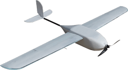
Efficient - Using our 25 years of experience in the drone industry, we created a fleet of aircraft that perform missions of all sizes in a wide range of conditions.
Safe - We implement industry-leading safety and maintenance procedures that mitigate risk.
Accurate - We follow strict standards set by ASPRS to ensure our aerial surveys are accurate and reliable.
Cutting Edge - We use advanced sensors to provide the best data possible.
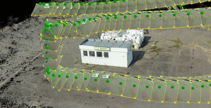
PROCESS
Industry Leading - We constantly test and upgrade our software to ensure we are using latest and most advanced technology in the industry.
Rapid Turnaround - Our industry-leading software and cutting edge computers ensure you receive the data fast.
High Quality - Using a series of QA/QC standards we ensure our data meets or exceeds survey-grade criteria.
ANALYTICS
Human-Derived Analytics - We do not rely on an algorithm to generate your results. We have created a team of the best GIS professionals to ensure accuracy.
Sophisticated - 3-dimensional, volumetric, geo-spatial, and geo-statistical analysis.
Specialized - Visualization and modeling techniques implemented to enhance derived solutions.
PE & RS - Photogrammetric Engineering & Remote Sensing Professionals.
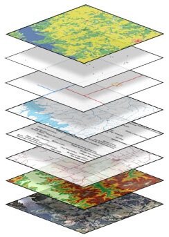
ACTIONABLE INTELLIGENCE
Data-Derived Solutions
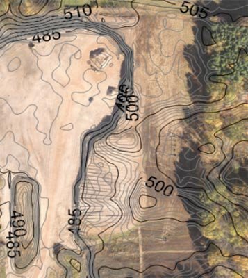
Digital Surface Model (DSM)
Topography
Volumetric
Thermal Mapping
Time Lapsed Imagery and Video
Obliques
Hi-Res Video and Imagery
We are evolving within a fast growing industry. Please contact us with any questions or if you would like a quote!
Want more information?
FEEDBACK FROM REAL CLIENTS
What Our Clients Are Saying
I had the pleasure of working with ISX Aerial's team in 2015 for a few days at our site. They were a very highly skilled and professional staff, in the field of UAV flying. They flew both a fixed wing and a multirotor aircrafts to map the landfill with great efficiency; we still use the map and photos to this day. They had no problems following all safety rules that we have on our site.
ISX Aerial would be welcome to our site when we're in need of another Aerial photo mapping project.
- Mark Parker
The ISX team was very professional and safe. I would use them for all of my future drone mapping needs. They provided amazing deliverables, and had additional services that really set them apart from all of the other aerial mapping companies.
- Frank Miller
A U S T I N T E X A S
ABOUT ISX AERIAL
ISX Aerial is a proud division of Integrated Science and Xploration, Inc. We provide remote sensing, drone mapping services, and analytics for applications like environmental engineering, surveying, building inspection, agriculture, and much more.